Tracy’s Recommendations

main

ROAD BIKING ROUTES:

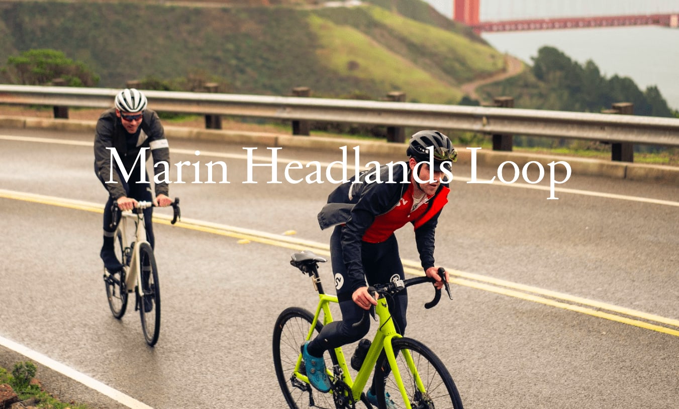
1. Sausalito - Marin Headlands Loop

2. Mill Valley - Muir Woods Loop

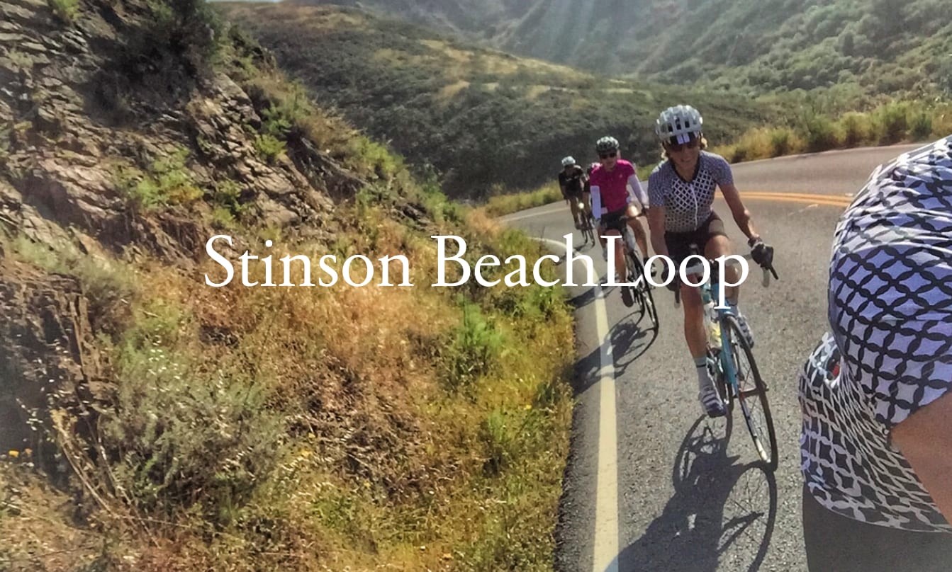
3. Mill Valley - Stinson Beach Loop

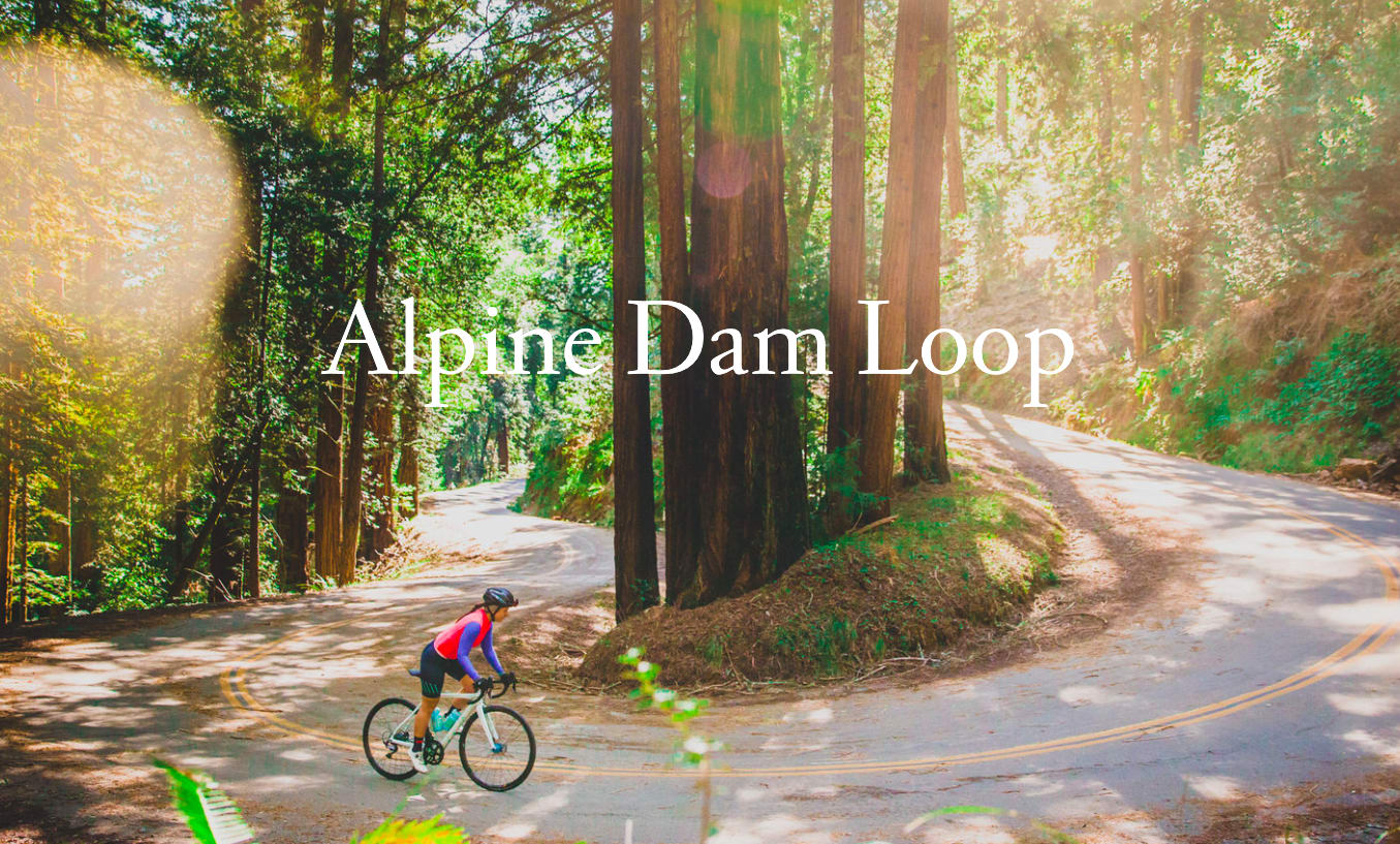
4. Fairfax - Alpine Dam Loop

5. Lucas Valley - Lucas Valley Loop

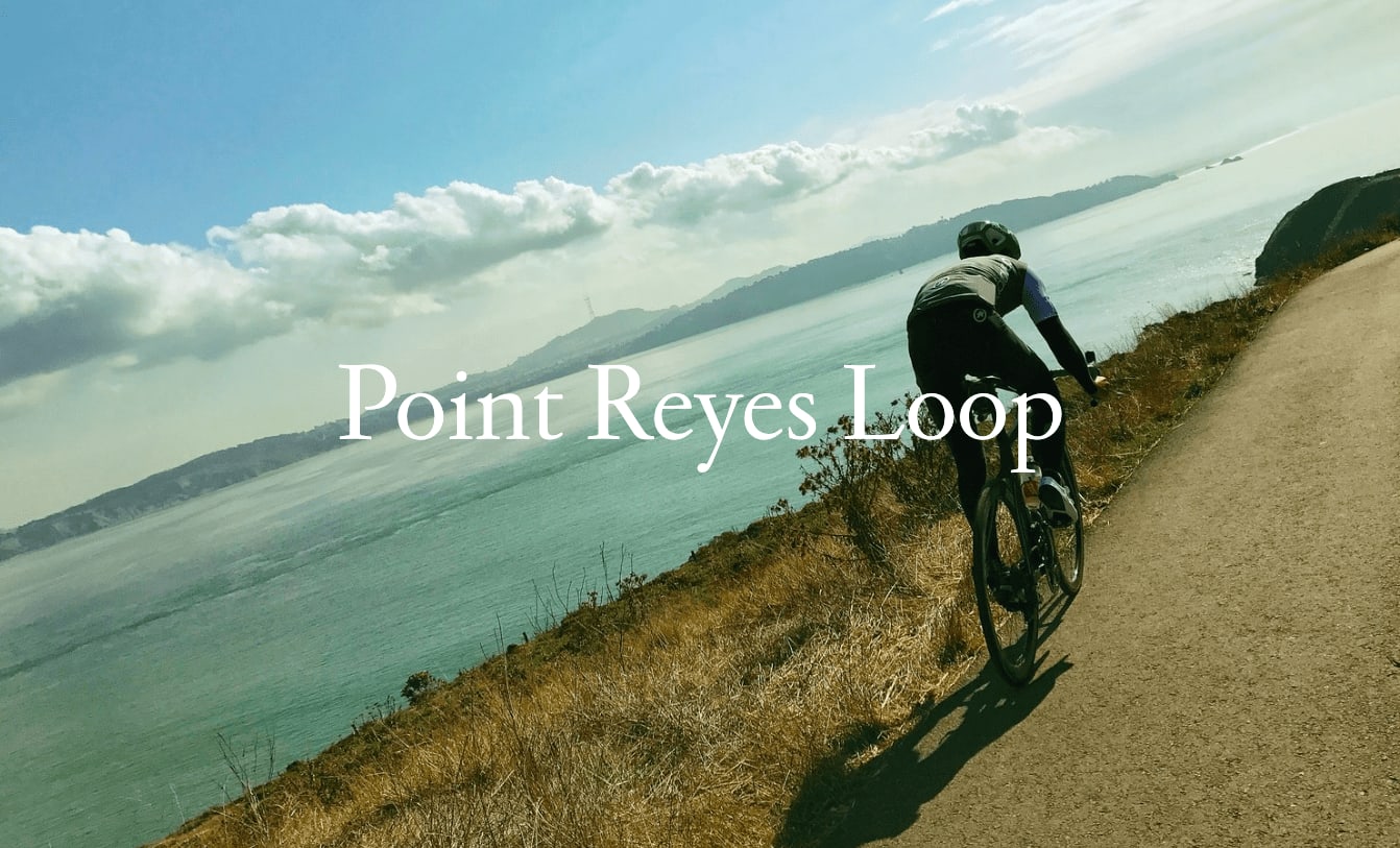
6. West Marin - Point Reyes Loop

*Below route information courtesy of Studio Velo.

*Below routes start in Mill Valley, yet starting points are flexible and can be easily started in various locations in Marin County.

MORE INFO ON ROAD BIKING ROUTES

Credit to: Studio Velo
 
Offering one of the most spectacular views of the famous Golden Gate Bridge and San Francisco, this relatively short pedal is a must-do Bay Area ride. Recently paved and with some bike lanes on the principal climb, the Headlands Loop from Mill Valley provides a perfect recovery ride but with some standard Marin climbing. Starting in Mill Valley offers a nice 15-minute warm-up before you begin to climb out of Sausalito. Don’t miss a stop at Equator Coffee on Bridgeway on the way back for some of the best espresso and pastries in the Bay Area.
 
Credit to: Studio Velo
 
The Muir Loop is a must-do, local Marin County ride that we refer to as the ‘lunch ride’. At approximately 60 minutes in duration with about two thousand feet of climbing with no steep pitches, this ride can be done in either direction once you arrive at Four Corners. From downtown Mill Valley, the counter-clockwise direction is shown above. We do not recommend climbing from Tam Junction up Highway 1. This ride passes through the historic Muir Woods National Monument and the Golden Gate National Recreation Area.
 
Credit to: Studio Velo
 
This is another world-class ride that takes less than two hours and will blow your socks off. Incredible views, over 3K feet of climbing, and two silky smooth descents will make you wish this was your backyard evening ride.
 
 
Credit to: Studio Velo
 
Alpine Dam Loop offers one of the most scenic rides in all of Marin. Meandering your way through a few of Marin County’s most lovely towns (Larkspur, Kentfield, Ross, etc.), on your way to some of the most fantastic climbs and epic scenery in southern Marin, the treasures and rewards of this ride are second to none. Riding this loop in a counterclockwise fashion will provide for a ride filled with majestic views, great climbs & descents, and most importantly a safe finish down Highway 1.
 
Credit to: Studio Velo
 
The ride, shaped like a lollipop on a map, breaks up into two main parts. The stick, to and from Fairfax, and the loop, which runs out Lucas Valley Road and into Nicasio Valley road and back to Fairfax along Sir Francis Drake make-ups this fun ride. This ride is an ideal loop if you have three or less hours, and do not want to be climbing the whole time. Lucas Valley road is one of the flattest, well-paved roads in southern Marin. The total ride climbs just under 2500 vertical feet, broken up into several 500-600 ft hills, making the Lucas Valley Loop one of our "roller" rides here in Marin.
 
Credit to: Studio Velo
 
The many back roads of West Marin County offer up almost limitless route choices and accommodate all types of riding preferences. On this ride, you’ll have a chance to ride over and along the two largest ridges that define Marin’s western geography, with each straddling a side of the famous San Andreas earthquake fault. The ride combines a fairly easy, rolling hill beginning with a couple of classic Marin climbs for a challenging ending. You’ll get outstanding views of the Pt. Reyes National Seashore and the Golden Gate National Recreation Areas.
 
main

MOUNTAIN BIKE ROUTES:

1. Mill Valley -Tennessee Valley/Muir Beach Loop

2. Mill Valley - Old Railroad Grade

3. Fairfax - Camp Tamarancho Loop

4. San Rafael - China Camp State Park Loop

MORE INFO ON MOUNTAIN BIKING ROUTES

An excellent ride that hits most of the single tracks in Southern Marin! You will begin your trek at the parking lot at the dead end of Tennessee Valley and quickly enter Miwok. Some riders have mentioned needing to walk portions of the trail due to how steep it is, so keep this in mind when planning your trip! This ride also passes you through Dipsea, a lavish 2.5 mile stretch of the Coastal View Trail and on a clear day – the Golden Gate Bridge.


Read More

Guaranteed to get you to the top of Mt. Tam with minimal suffering, this gentle grade used to be an old railroad bed. It offers not only outstanding views of the San Francisco Bay and Marin coastline, but is also considered one of the top trails in Marin County! Before you begin your descent, stop at the West Point Inn to grab some water and refuel.


Read More

While it is a local favorite - this trail isn’t for the faint of heart, as most will rate it as difficult or advanced! If you do dare to take on the adventure through the Fairfax hills – you will make your way up the daring climb Serpentine Trail has to offer. Keep in mind, this loop requires a permit that can be purchased from Sunshine bicycles in Fairfax or online from the Boy Scouts of Marin.


Read More

Known for how well-maintained it is and its views of the bay, this trail is a great opportunity to make your way around the McNear’s area. Not to mention the great local eateries right on the water after your ride! While it has been known to be congested at times, the six miles of rolling downhill after the climb makes it well worth it.


Read More

main

HIKING ROUTES:

1. Mill Valley -Tennessee Valley/Muir Beach Loop

2. Mill Valley - Dipsea Trail to Stinson Beach

3. Larkspur - Baltimore Canyon via Dawn Falls

4. Ross - Phoenix Lake Loop

5. Fairfax - Bon Tempe Lake Loop

6. Fairfax - Cataract Falls

MORE INFO ON HIKING TRAILS

This hike will allow you some of the most breathtaking views once you reach the Golden Gate overlook. For those not familiar with Marin, this spot will offer you the chance to see some of the most renowned areas of Marin – all at once! Take first stairway at Excelsior Lane (179 steps) and follow the curve around Santa Rosa to take the next stairway to Spencer (another 187 steps). Make your way to the to the Alta Trail – if you leave early enough, this is a great place to catch the sunrise! Make your way to the SCA Trail to the Coastal Trail to views of the Golden Gate!


Read More

Guaranteed to get you to the top of Mt. Tam with minimal suffering, this gentle grade used to be an old railroad bed. It offers not only outstanding views of the San Francisco Bay and Marin coastline, but is also considered one of the top trails in Marin County! Before you begin your descent, stop at the West Point Inn to grab some water and refuel.


Read More

Begin your hike in Larkspur and take a journey through the canyon. This hike doesn’t just offer beautiful views of the vistas, but you’ll also be met with fern-covered forests and stunning waterfalls. Parking can be tricky here, so if you do not mind a longer hike you can park near Dolliver Park on Madrone Road. Once you’re done with your hike, downtown Larkspur is home to Perry’s on Magnolia, one of the most divine American-style eateries in the Bay – and it’s the perfect way to finish a long hike!


Read More

This trail is excellent for the family and don’t forget to bring your pup! Beginning at Lagunitas Road, you will begin your journey at the northern most part of the lake. For the first mile, it is wheelchair and stroller friendly until you begin towards the hiking-only southern portion of the trail. Since this trail is heavily trafficked, it makes it safer for the solo hiker or jogger!


Read More

Another dog-friendly option and great for all skill levels, this trail is located near Fairfax and provides serene views of Bon Tempe Lake (which offers fun activities in the summer time!). While a good portion of the loop is facing the open lakeside, you can also find moments passing through the trees. Make sure to check the weather prior to making your journey – clear days are the best time to enjoy this trail.


Read More

The trailhead for this stunning hike is located just off Bolinas Fairfax Road, past Alpine Lake. You can reach the falls from Cataract Trail, which follows alongside a quaint creek through the shaded forest. You will even pass through a picnic area! A great place to stop and enjoy an early lunch and take in the sights and sounds. If not here, another great place to stop if by the little pool just off the junction. Keep in mind – while the hike is short, a good portion of it is uphill. So if you are looking for a good workout – this one is for you!


Read More

Connect With Tracy

Elevate your real estate journey with Tracy Curtis’s dynamic blend of Olympic discipline and Hollywood agent finesse. Guided by transparent communication, Tracy offers data-driven insights tailored to buyers, and strategic marketing solutions for sellers. Her extensive education from UCLA and USC underscores her expertise, and her commitment to excellence and authenticity sets her apart as a trusted partner who goes the extra mile to meet your unique needs. Whether you're buying or selling, Tracy's approach guarantees a seamless and successful process, making your real estate venture truly exceptional.